- Location : Home» Newsroom
Remote sensing estimation of sugar beet SPAD based on un-manned aerial vehicle multispectral imagery
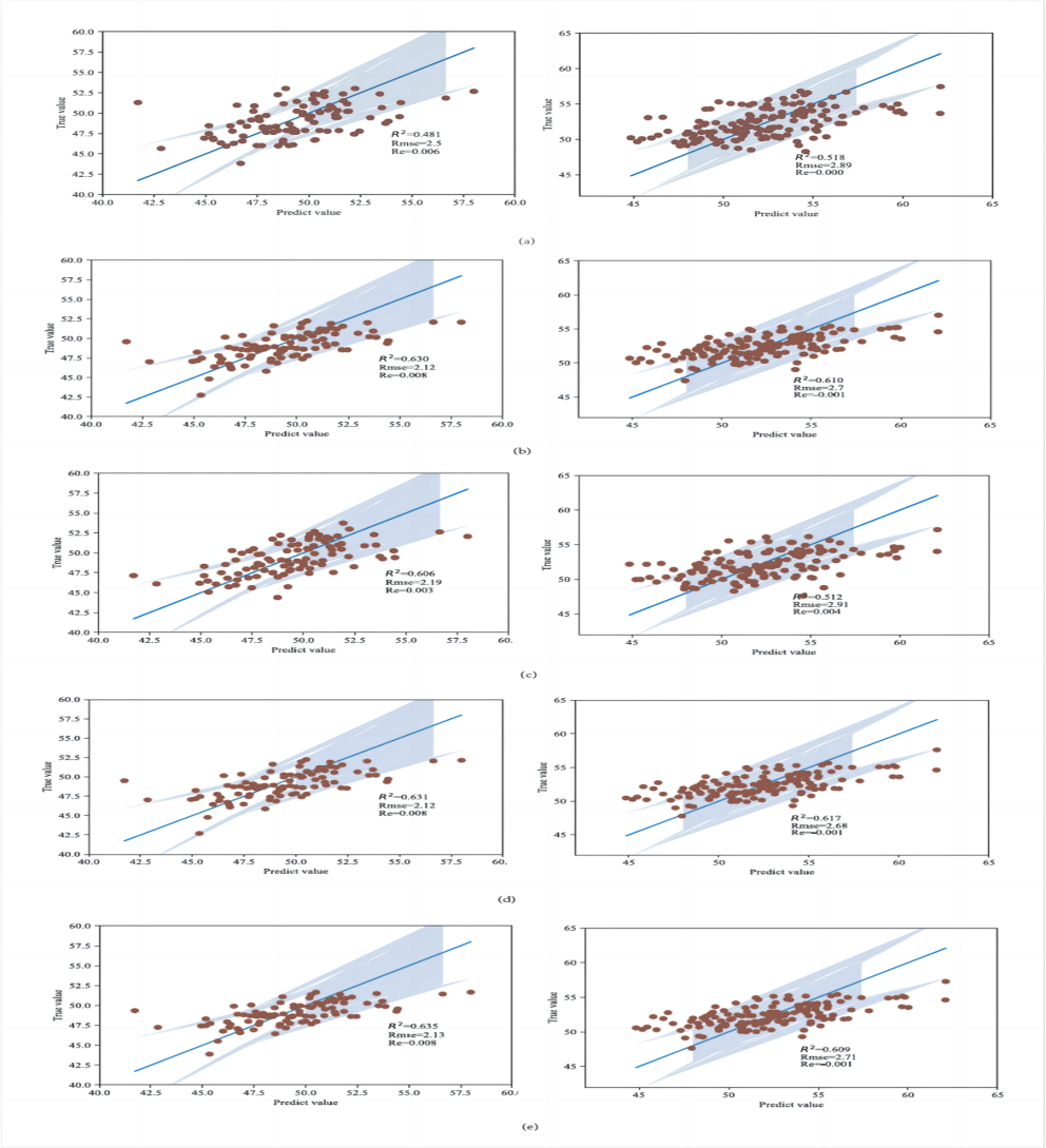
Accurate, non-destructive and cost-effective estimation of crop canopy Soil Plant Analysis De-velopment(SPAD) is crucial for precision agriculture and cultivation management. Unmanned aerial vehicle (UAV) platforms have shown tremendous potential in predicting crop canopy SPAD. This was because they can rapidly and accurately acquire remote sensing spectral data of the crop canopy in real-time. In this study, a UAV equipped with a five-channel multispectral camera (Blue, Green, Red, Red_edge, Nir) was used to acquire multispectral images of sugar beets. These images were then combined with five machine learning models, namely K-Nearest Neighbor, Lasso, Random Forest, RidgeCV and Support Vector Machine (SVM), as well as ground measurement data to predict the canopy SPAD of sugar beets. The results showed that under both normal irrigation and drought stress conditions, the SPAD values in the normal ir-rigation treatment were higher than those in the water-limited treatment. Multiple vegetation indices showed a significant correlation with SPAD, with the highest correlation coefficient reaching 0.60. Among the SPAD prediction models, different models showed high estimation accuracy under both normal irrigation and water-limited conditions. The SVM model demon-strated a good performance with a correlation coefficient (R2) of 0.635, root mean square error (Rmse) of 2.13, and relative error (Re) of 0.80% for the prediction and testing values under normal irrigation. Similarly, for the prediction and testing values under drought stress, the SVM model exhibited a correlation coefficient (R2) of 0.609, root mean square error (Rmse) of 2.71, and rela-tive error (Re) of 0.10%. Overall, the SVM model showed good accuracy and stability in the pre-diction model, greatly facilitating high-throughput phenotyping research of sugar beet canopy SPAD.
